
DRONE SURVEY SERVICE
Aerial Mapping & Orthomosaics
Geo-referenced, survey-grade aerial mapping and orthomosaics that give your project team a single, accurate view of the whole site.
Ideal for baseline records, planning applications, design reviews and stakeholder communication across civil engineering and groundworks projects.
OVERVIEW
What Is Aerial Mapping & Orthomosaic Surveying?
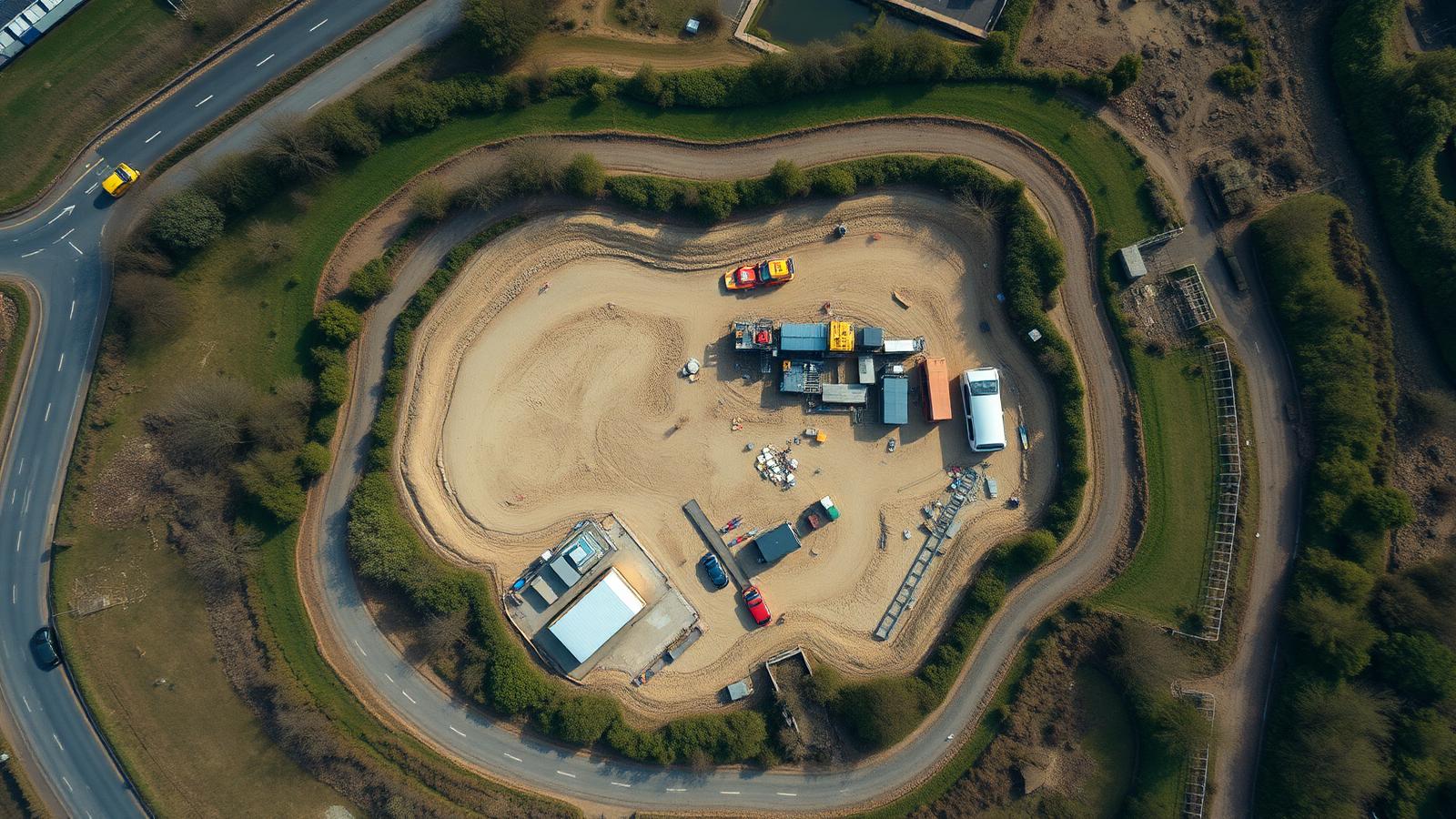
An orthomosaic is a high-resolution, distortion-corrected aerial map stitched together from hundreds of overlapping drone images. Because every pixel is geo-referenced and scaled to real-world coordinates, you can measure, annotate and design directly on top of it.
We capture your site using RTK-enabled survey drones flying pre-programmed missions, then process the imagery in industry-standard photogrammetry software. The result is a true-to-scale map — typically at 1–2cm ground sample distance — delivered as GeoTIFF, PDF and directly into your CAD or GIS environment.
FEATURES
What's Included In A Aerial Mapping & Orthomosaics Survey
Every aerial mapping & orthomosaics project is delivered end-to-end — from RTK-controlled capture through to CAD-ready outputs your team can use immediately.
1–2cm Ground Resolution
Full-frame imaging payloads capture pin-sharp detail across the entire site footprint.
RTK Geo-Referencing
Every pixel tied to OSGB36 or your project grid, validated against ground control.
Layered Deliverables
Orthomosaic, DSM and site-wide contour overlays supplied together in one delivery pack.
CAD & GIS Ready
GeoTIFF, DWG, KML and PDF outputs drop straight into AutoCAD, Civil 3D, QGIS or ArcGIS.
Repeatable Missions
Programmed flight lines re-flown each visit for true like-for-like comparison over time.
Fully Compliant
CAA-authorised pilots, £5m public liability and site-specific RAMS on every job.
LEARN MORE ABOUT OUR SERVICES
Aerial Mapping & Orthomosaics
High-resolution, geo-accurate aerial maps that give your team a true picture of the site from day one.
WHY IT MATTERS
Benefits Of Drone Aerial Mapping & Orthomosaics
How this service moves the needle on your programme, budget and commercial position.
Complete Site Visibility
One map replaces dozens of ground-level photos — you see every access point, boundary and constraint at a glance.
Faster Design Reviews
Engineers and designers work from the same accurate base map, cutting hours out of every review cycle.
Lower Survey Cost
One drone flight typically captures what would take a ground survey team several days on site.
Better Stakeholder Reporting
Board-ready visuals raise the quality of your monthly reporting with zero extra internal effort.
SPEAK TO A SPECIALIST
Prefer To Talk It Through? Call Our Survey Team Today
Skip the form — pick up the phone and speak directly to a specialist who understands civil engineering and groundworks projects. We'll answer your questions, scope your survey and provide a fixed, no-obligation quote in minutes.
Mon–Fri · 8am–6pm · UK Wide
THE PROBLEM WE SOLVE
The Problem It Solves
Ground-level photos and outdated OS maps leave design teams working from partial, out-of-date information. That drives site queries, RFIs and expensive rework once construction begins.
A geo-referenced orthomosaic gives every discipline — design, commercial, planning and site management — a single, up-to-date source of truth for the whole site.
- Fewer design RFIs during pre-construction
- Faster planning and stakeholder sign-off
- Accurate baseline evidence for the entire programme
EXPLORE MORE
Part Of Our Full Drone Survey Service
Aerial Mapping & Orthomosaics is one of six specialist drone survey services we deliver to civil engineering, groundworks and infrastructure teams across the UK.
GET IN TOUCH
Let's Discuss Your Project
Whether you require a one-off drone survey or ongoing project reporting, we're here to help.
Aerial Mapping & Orthomosaics FAQs
An orthomosaic is a high-resolution aerial map stitched from hundreds of overlapping drone photographs and corrected for lens distortion and terrain. Every pixel is geo-referenced to real-world coordinates, so your team can measure distances, calculate areas and design directly on top of it in AutoCAD, Civil 3D, QGIS or any GIS environment.